Geography
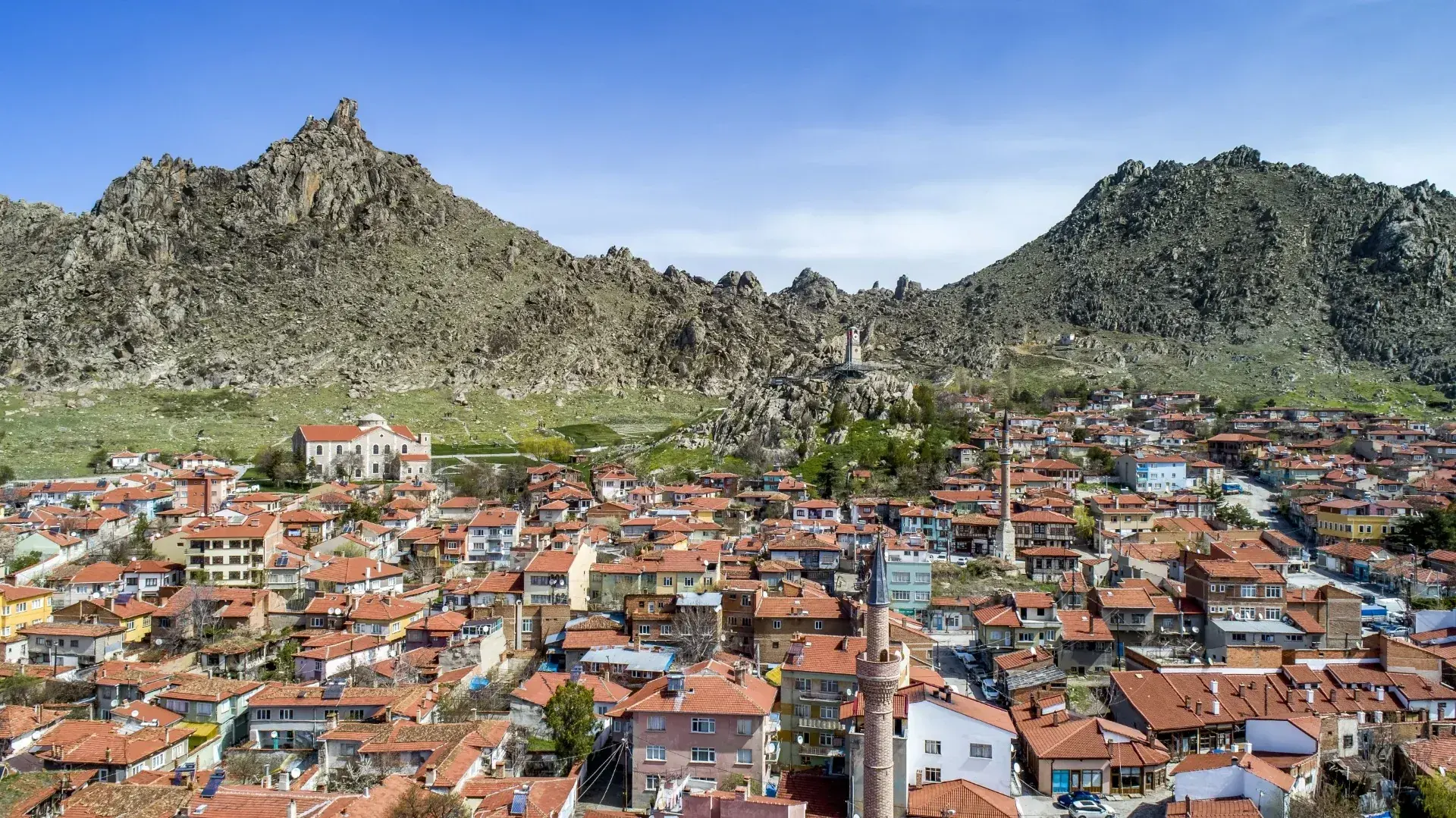
Sivrihisar lies in Central Anatolia within Eskişehir province. Open agricultural land contrasts with the rocks around the historic centre. The Sakarya basin and its wetlands introduce another side of the district’s landscape.
A town around the rocks, a culture within its streets.
From a distance, rocks and rooftops shape the first impression. Walk closer and the view becomes timber columns, stone doorways, woven patterns and conversations around a local table. Discovering the district means reading its past together with the life of today.
Sivrihisar lies in Central Anatolia within Eskişehir province. Open agricultural land contrasts with the rocks around the historic centre. The Sakarya basin and its wetlands introduce another side of the district’s landscape.
The continental climate brings hot, dry summers and cold winters. Prepare for the season, especially around exposed viewpoints and rural sites. At Balıkdamı, observe birds quietly and from a respectful distance.
The district is on the Ankara–Eskişehir road, close to the junction towards Afyonkarahisar. Approximate road distances are 100 km from Eskişehir and 135 km from Ankara; the actual journey depends on your starting point and route.
The year-end 2025 population was 20,189, including 10,464 men and 9,725 women. These figures cover the whole district, including rural neighbourhoods. Agriculture, small businesses and local craftsmanship contribute to everyday life.
The district cannot be explained through one monument or one period. Religious buildings, mansions and ordinary houses introduce the historic centre, while archaeological sites outside it open into earlier landscapes.
Look between the major sights as well as at them. A timber window, a stone façade, a shop or a textile pattern can show how older ways of making and living remain present.
Pessinus at Ballıhisar is associated with the Mother Goddess cult. The archaeological site introduces ancient layers that differ from the surviving historic fabric of today’s town.
The development of the settlement was connected with Byzantine military roads and defensive needs. The name Iustinianopolis recalls building activity associated with Emperor Justinian I.
The Great Mosque, smaller prayer houses and monumental tombs preserve different aspects of the medieval town. Materials, decorative details and building types reveal more than a single historical label.
Mosques, markets and houses supported the town’s daily life. Scholars and writers also connect Sivrihisar with a wider intellectual world. Historic residences still help visitors read this past at street level.
The district’s liberation from occupation is commemorated on 20 September. Zaim Ağa Mansion is remembered for hosting a meeting of the government’s executive council outside Ankara.
Weaving, food, storytelling, sculpture and festivals carry local culture into contemporary life. The television series Gönül Dağı is also filmed here, but the district’s story reaches well beyond its screen appearances.
The Great Mosque is one of the five components of the Wooden Hypostyle Mosques of Medieval Anatolia World Heritage property. Its 67 timber posts create a distinctive interior rhythm. Look closely at the carved woodwork and the minbar, while respecting the building’s continuing use as a mosque.
Explore →At Ballıhisar, Pessinus introduces a different layer of the district’s past. The ancient settlement is known for its association with the Mother Goddess cult. Observe the visible remains from permitted areas and leave archaeological surfaces undisturbed.
Explore →The Armenian church forms a striking part of Sivrihisar’s architectural heritage. Study the scale of the façade, the arches and the stonework. Its presence helps visitors understand the different communities and periods that shaped the town.
Explore →Balıkdamı is a wetland in the Sakarya basin and an important setting for bird life. Observe from a distance, keep noise low and avoid disturbing wildlife. Conditions can vary with season and weather, so plan access carefully.
Explore →Zaim Ağa Mansion is associated with the Turkish War of Independence and a meeting of the Grand National Assembly government’s executive council outside Ankara. Its stone and timber details can be explored together with the surrounding historic streets.
Explore →The Clock Tower is one of Sivrihisar’s recognisable landmarks. Its elevated setting brings rooftops, historic streets and the surrounding rocks into one view. Allow time to enjoy the changing light, and use safe paths around the sloping terrain.
Explore →Kilim weaving, jewellery such as incili küpe and cebe, and local cooking form different parts of the district’s cultural memory. Ask makers about their materials and processes, rather than seeing a finished object or meal alone.
Nasreddin Hoca stories, the Culture House and contemporary sculpture introduce other ways in which place and memory meet. A museum room and an ordinary market conversation can both begin a discovery.